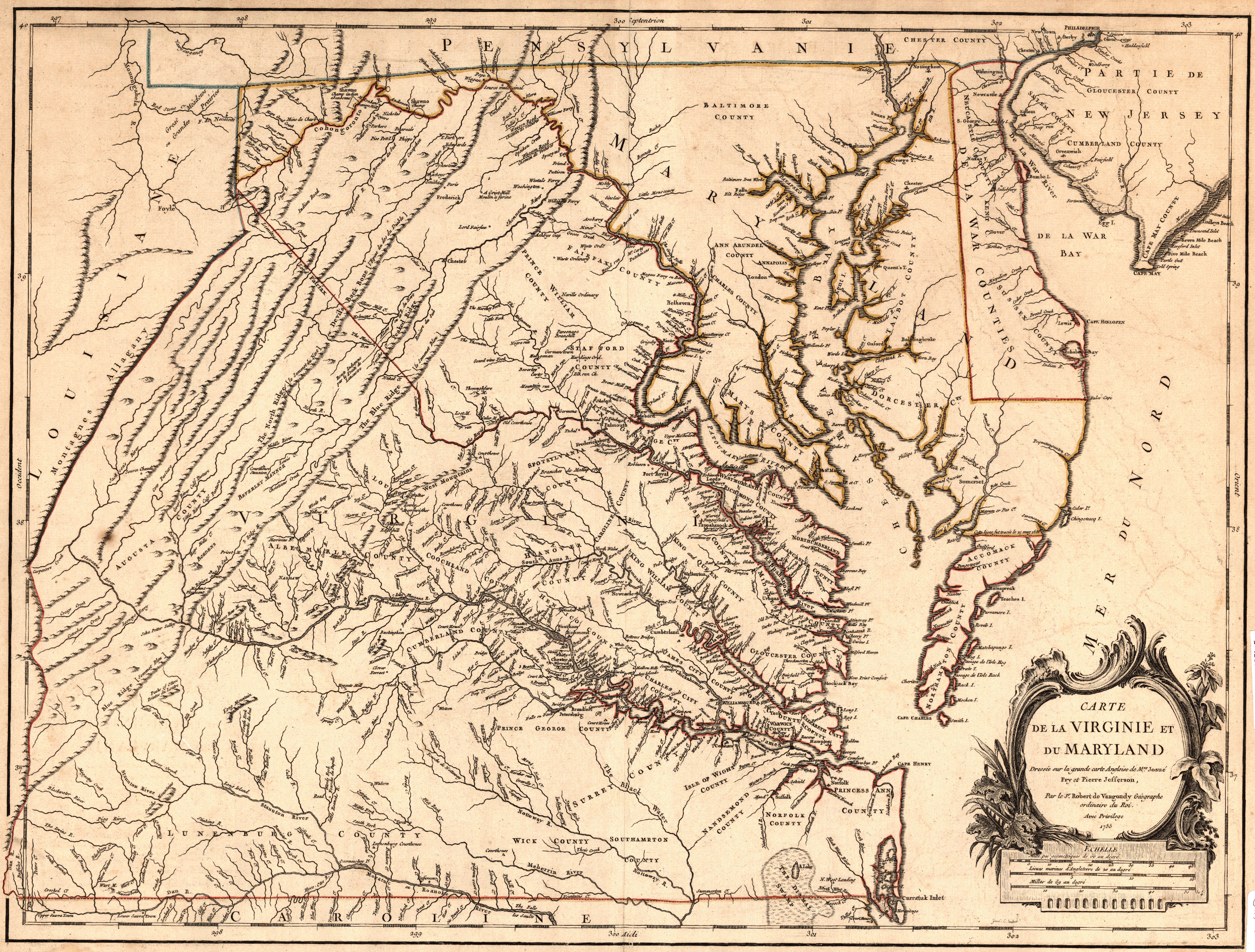
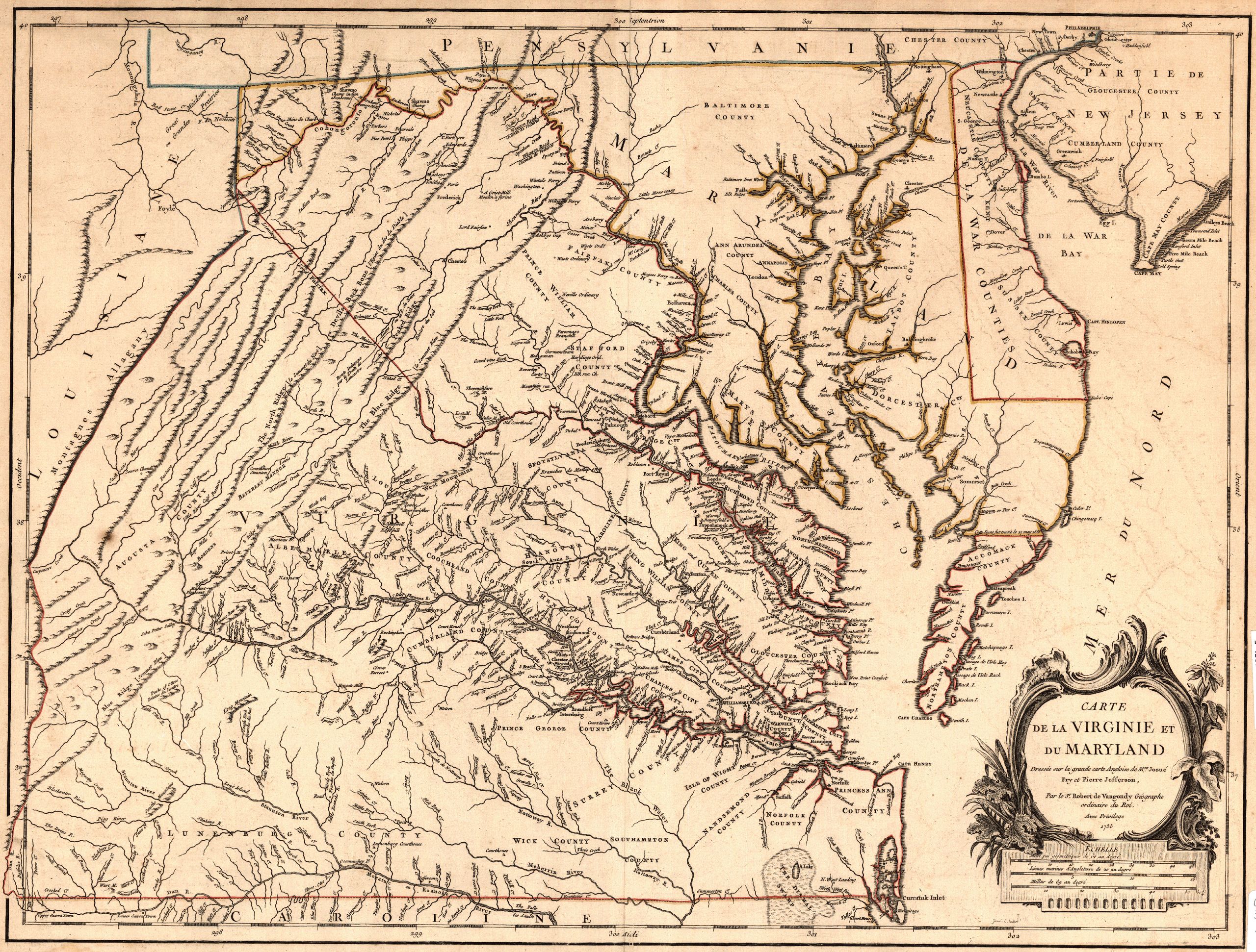
File:Carte de la Virginie et du Maryland Dresse sur la grande carte Angloise de Mrs Josu Fry et Pierre Jefferson Par le Sr Robert de Vaugondy Gographe ordinaire du Roi.jpg
Original file (6,399 × 4,854 pixels, file size: 8.19 MB, MIME type: image/jpeg)
A map of Virginia dating from around 1757. This map is the work of Robert de Vaugondy.
This image was obtained from: "Carte de la Virginie et du Maryland Dressée sur la grande carte Angloise de Mrs. Josué Fry et Pierre Jefferson, Par le Sr. Robert de Vaugondy Géographe ordinaire du Roi", University Libraries (University of Washington)
A clearly related version of this map is available at http://cartweb.geography.ua.edu/lizardtech/iserv/calcrgn?cat=North%20America%20and%20United%20States&item=States/Virginia/Virginia1755a.sid&wid=500&hei=400&props=item(Name,Description),cat(Name,Description)&style=simple/view-dhtml.xsl
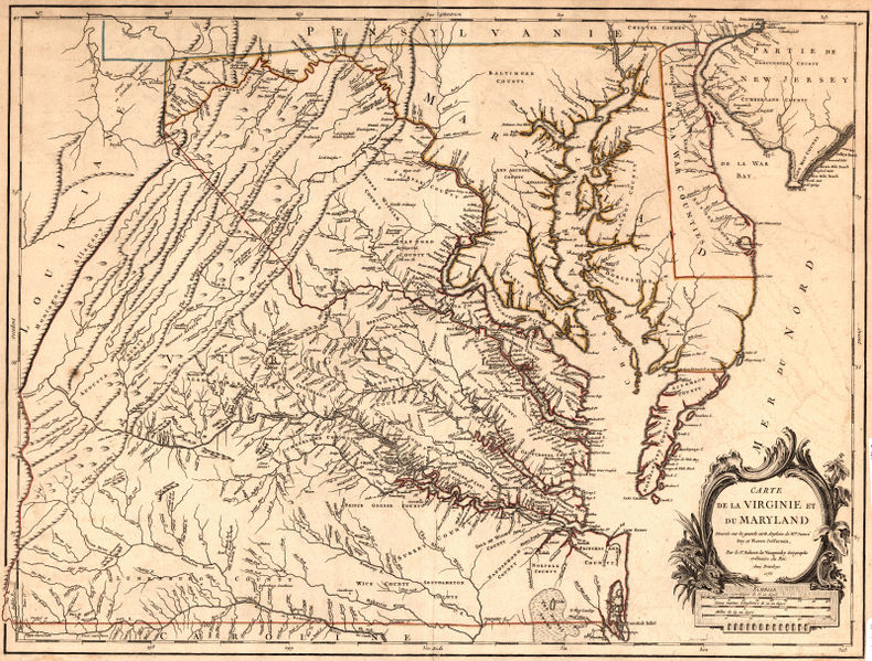
An apparently updated version of this map with contemporary county identifications in 1770.
Areas of Interest
Goose Creek, referred to in the Will of John Turner, is located at 300 (horizontal), 39 (vertical).
File history
Click on a date/time to view the file as it appeared at that time.
| Date/Time | Thumbnail | Dimensions | User | Comment | |
|---|---|---|---|---|---|
| current | 20:53, 30 April 2016 | | 6,399 × 4,854 (8.19 MB) | Seanmcox (talk | contribs) | A map of Virginia dating from around 1757. This map is the work of Robert de Vaugondy. This image was obtained from: [http://digitalcollections.lib.washington.edu/cdm/ref/collection/maps/id/49 "Carte de la Virginie et du Maryland Dressée sur la gran... |
You cannot overwrite this file.
File usage
The following 5 pages use this file: