File:Philpott Dam, planning map 2, below Goblintown Creek junction to dam site.jpg
Original file (3,072 × 2,304 pixels, file size: 1.43 MB, MIME type: image/jpeg)
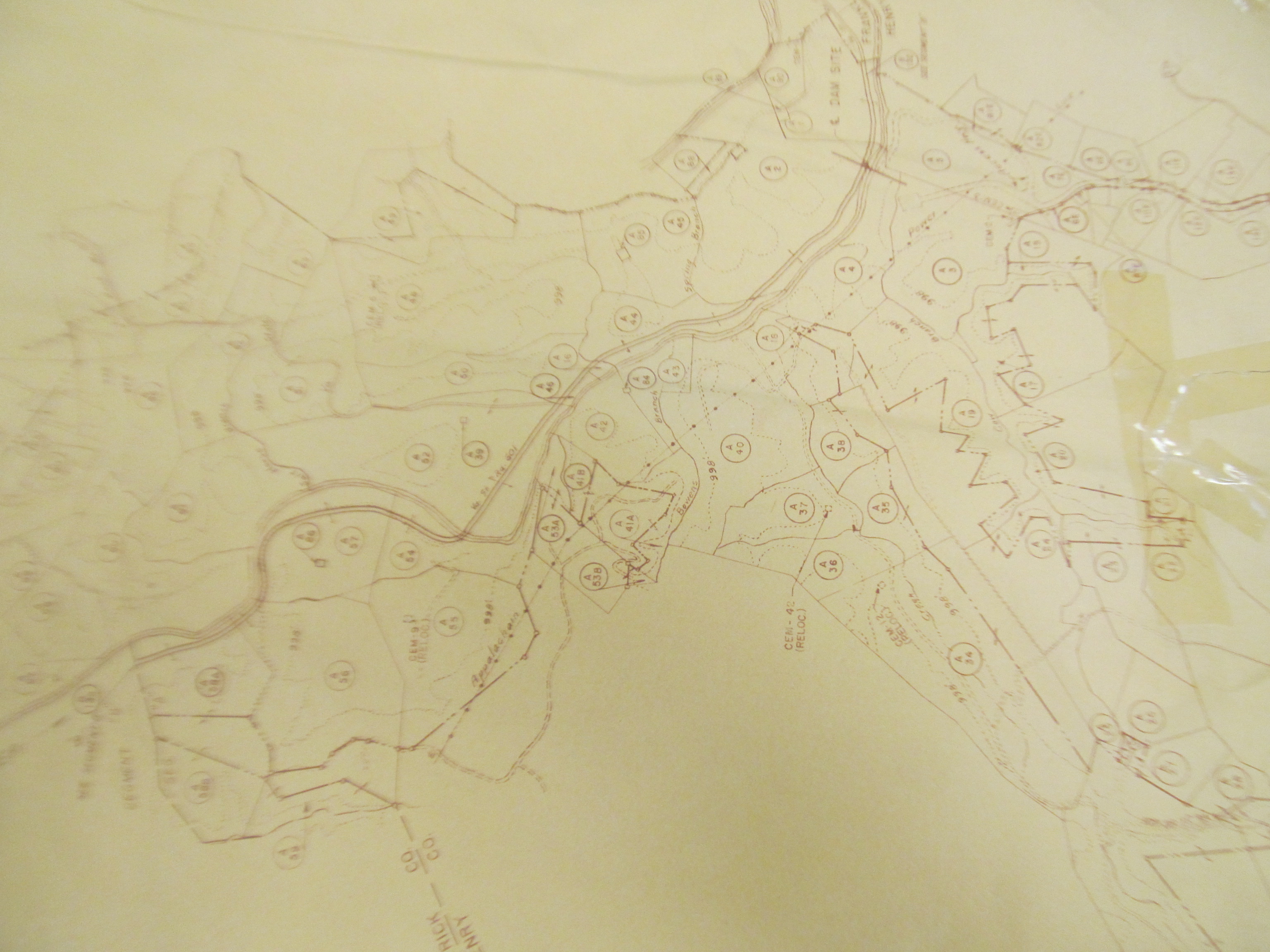
Picture taken at the Bassett Historical Center from a map they had filed. It dates from the period in which the Philpott Dam was being planned. It show the river and outlines for nearby pieces of property.
This section shows some detail of the area below the junction of the Goblintown Creek where it feeds into the Smith/Irwin river all the way to the proposed dam site. The Smith River runs from the left of the image out to the top of the image. The image is oriented so that North is to the left.
In his will, John Turner described a piece of land that he left to his daughters Jemima Turner and Mary Turner as "a piece of land on Smith River where I did formerly live on south side of river about one mile below the mouth of Goblintown Creek." In this image, the area about a mile below the junction is visible.
Related Images
File history
Click on a date/time to view the file as it appeared at that time.
| Date/Time | Thumbnail | Dimensions | User | Comment | |
|---|---|---|---|---|---|
| current | 17:43, 13 November 2016 | | 3,072 × 2,304 (1.43 MB) | Seanmcox (talk | contribs) | Picture taken at the [http://www.bassetthistoricalcenter.com/ Bassett Historical Center] from a map they had filed. It dates from the period in which the Philpott Dam was being planned. It show the river and outlines for nearby pieces of property. Thi... |
You cannot overwrite this file.
File usage
The following 3 pages use this file: