File:Virginia, Goose Point Park, Beech Point, Dock, South East.jpg
Original file (3,264 × 2,448 pixels, file size: 1.74 MB, MIME type: image/jpeg)
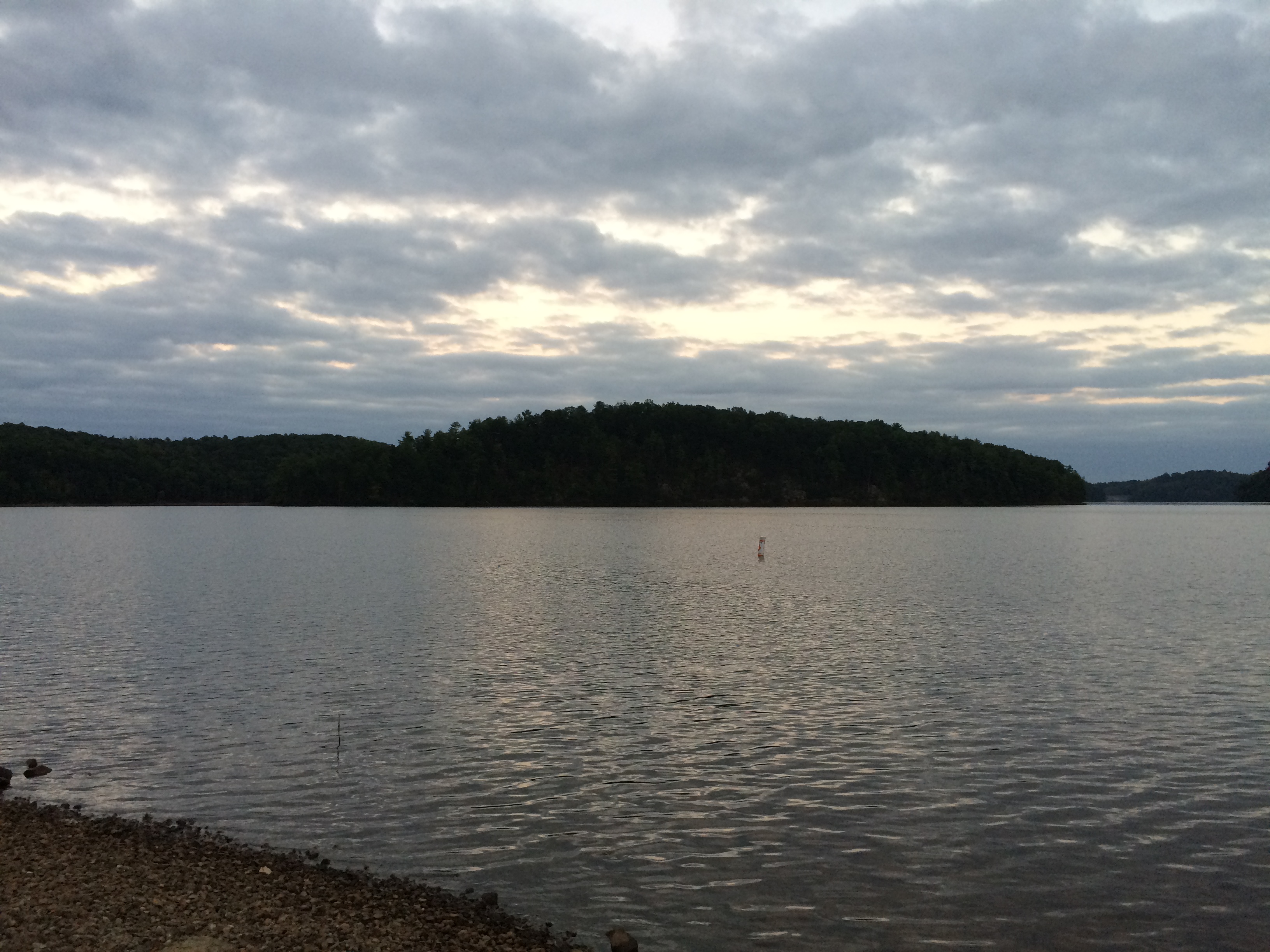
This photo was taken by Cassey Lynn Castillo in the late afternoon on 5 October 2016 on a dock at Beech Point in Goose Point Park, Bassett, Henry County, Virginia. The shot faces south east over Philpott Lake. In the middle is Turkey Island. On the right is an area that had probably once been land belonging to John Turner, probably including some of the shore in the background. On the left, Deer island can be seen peeking out from behind Turkey Island. The original course of the Smith River, before construction of the Philpott Dam, ran between the viewer and Turkey Island.
Related Images
- Virginia, Goose Point Park, Beech Point, Sign.jpg
- Virginia, Goose Point Park, Beech Point, Dock, West.jpg
- Virginia, Goose Point Park, Beech Point, Dock, South 1.jpg
- Virginia, Goose Point Park, Beech Point, Dock, South 2.jpg
- Virginia, Goose Point Park, Beech Point, Dock, South 3.jpg
- Virginia, Goose Point Park, Beech Point, Dock, South 4.jpg
- Virginia, Goose Point Park, Beech Point, Dock, South 5.jpg
- Virginia, Goose Point Park, Beech Point, Dock, South South East 1.jpg
- Virginia, Goose Point Park, Beech Point, Dock, South South East 2.jpg
- Virginia, Goose Point Park, Beech Point, Dock, South South East 3.jpg
- Virginia, Goose Point Park, Beech Point, Dock, South East.jpg
File history
Click on a date/time to view the file as it appeared at that time.
| Date/Time | Thumbnail | Dimensions | User | Comment | |
|---|---|---|---|---|---|
| current | 17:20, 30 October 2016 | | 3,264 × 2,448 (1.74 MB) | Seanmcox (talk | contribs) | This photo was taken by Cassey Lynn Castillo in the late afternoon on 5 October 2016 at [https://www.google.com/maps/place/Goose+Point+Park/@36.8000122,-80.0544256,1265m/data=!3m1!1e3!4m5!3m4!1s0x0:0x6d201eba4e06b7ac!8m2!3d36.8044522!4d-80.0587272... |
You cannot overwrite this file.
File usage
The following 2 pages use this file: