File:Lost Villages of the St Lawrence, commemorative sign near Moulinette.jpg
Size of this preview: 600 × 600 pixels.
Original file (2,448 × 2,448 pixels, file size: 2.35 MB, MIME type: image/jpeg)
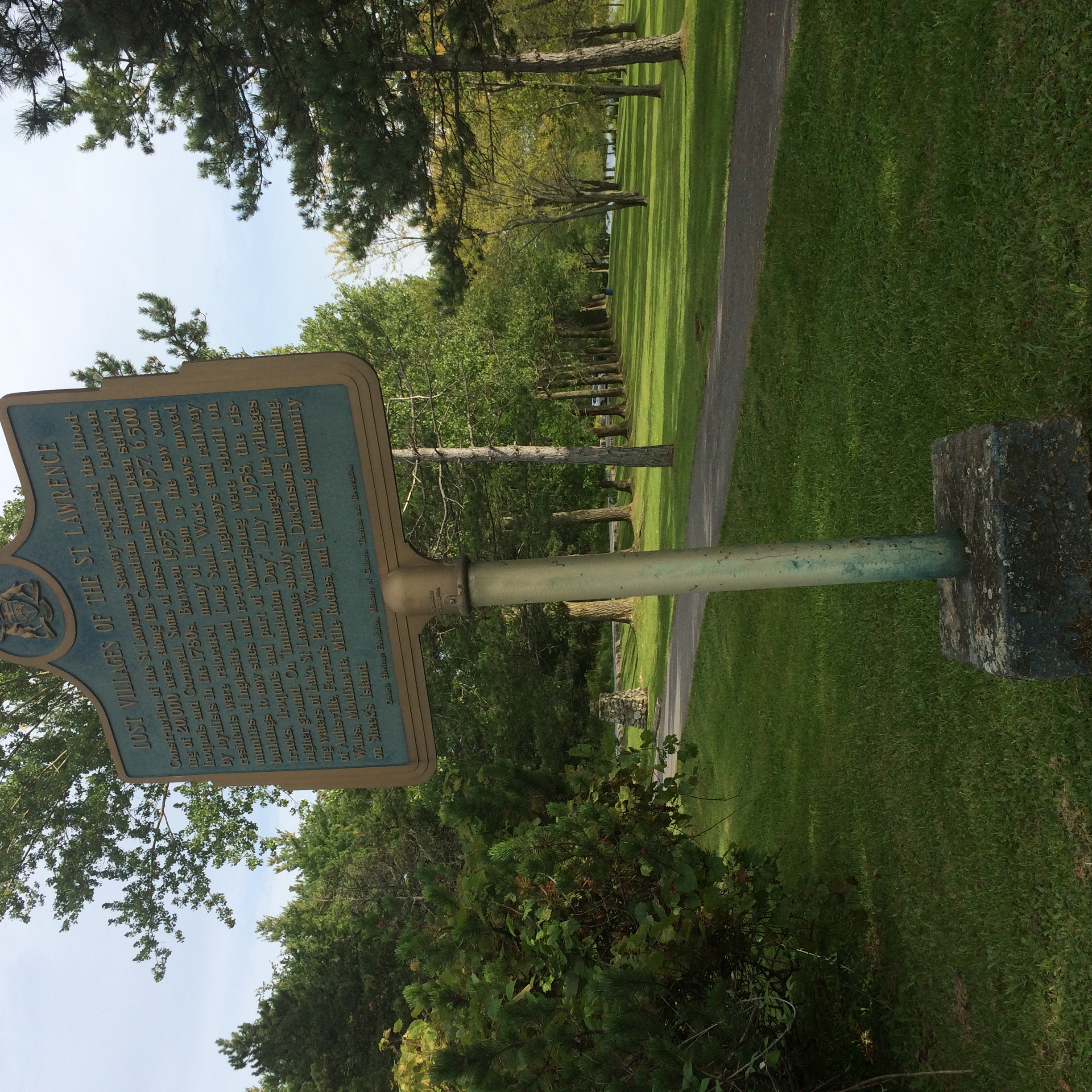
This picture was taken in August 2017. It is a sign posted near the original site of Moulinette, west of Cornwall. It is a little redundant because it sights very close to another commemorative sign, but it is more generic and gives different information.
File history
Click on a date/time to view the file as it appeared at that time.
| Date/Time | Thumbnail | Dimensions | User | Comment | |
|---|---|---|---|---|---|
| current | 19:36, 18 February 2018 | | 2,448 × 2,448 (2.35 MB) | Seanmcox (talk | contribs) | This picture was taken in August 2017. It is a sign posted [https://www.google.com/maps/@45.032284,-74.8576799,3a,75y,180h,90t/data=!3m6!1e1!3m4!1s0cW_S6RjC0P_R_rR8SeQiQ!2e0!7i13312!8i6656 near the original site of Moulinette], west of Cornwall. It is... |
You cannot overwrite this file.
File usage
The following page uses this file: