File:Moulinette, Lost Villages Historical Society, commemorative sign.jpg: Difference between revisions
Jump to navigation
Jump to search
(Added cross-reference link.) |
m (Added link.) |
||
| Line 1: | Line 1: | ||
This picture was taken in August 2017. It is a sign posted [https://www.google.com/maps/@45.032284,-74.8576799,3a,75y,180h,90t/data=!3m6!1e1!3m4!1s0cW_S6RjC0P_R_rR8SeQiQ!2e0!7i13312!8i6656 near the original site of Moulinette], west of Cornwall. The [[:File:Lost Villages of the St Lawrence, commemorative sign near Moulinette.jpg|other sign]], seen in the background, also has a photo on this site. | This picture was taken in August 2017. It is a sign posted [https://www.google.com/maps/@45.032284,-74.8576799,3a,75y,180h,90t/data=!3m6!1e1!3m4!1s0cW_S6RjC0P_R_rR8SeQiQ!2e0!7i13312!8i6656 near the original site] of [[Moulinette, Ontario, Canada]], west of Cornwall. The [[:File:Lost Villages of the St Lawrence, commemorative sign near Moulinette.jpg|other sign]], seen in the background, also has a photo on this site. | ||
Latest revision as of 19:48, 18 February 2018
This picture was taken in August 2017. It is a sign posted near the original site of Moulinette, Ontario, Canada, west of Cornwall. The other sign, seen in the background, also has a photo on this site.
File history
Click on a date/time to view the file as it appeared at that time.
| Date/Time | Thumbnail | Dimensions | User | Comment | |
|---|---|---|---|---|---|
| current | 19:30, 18 February 2018 | 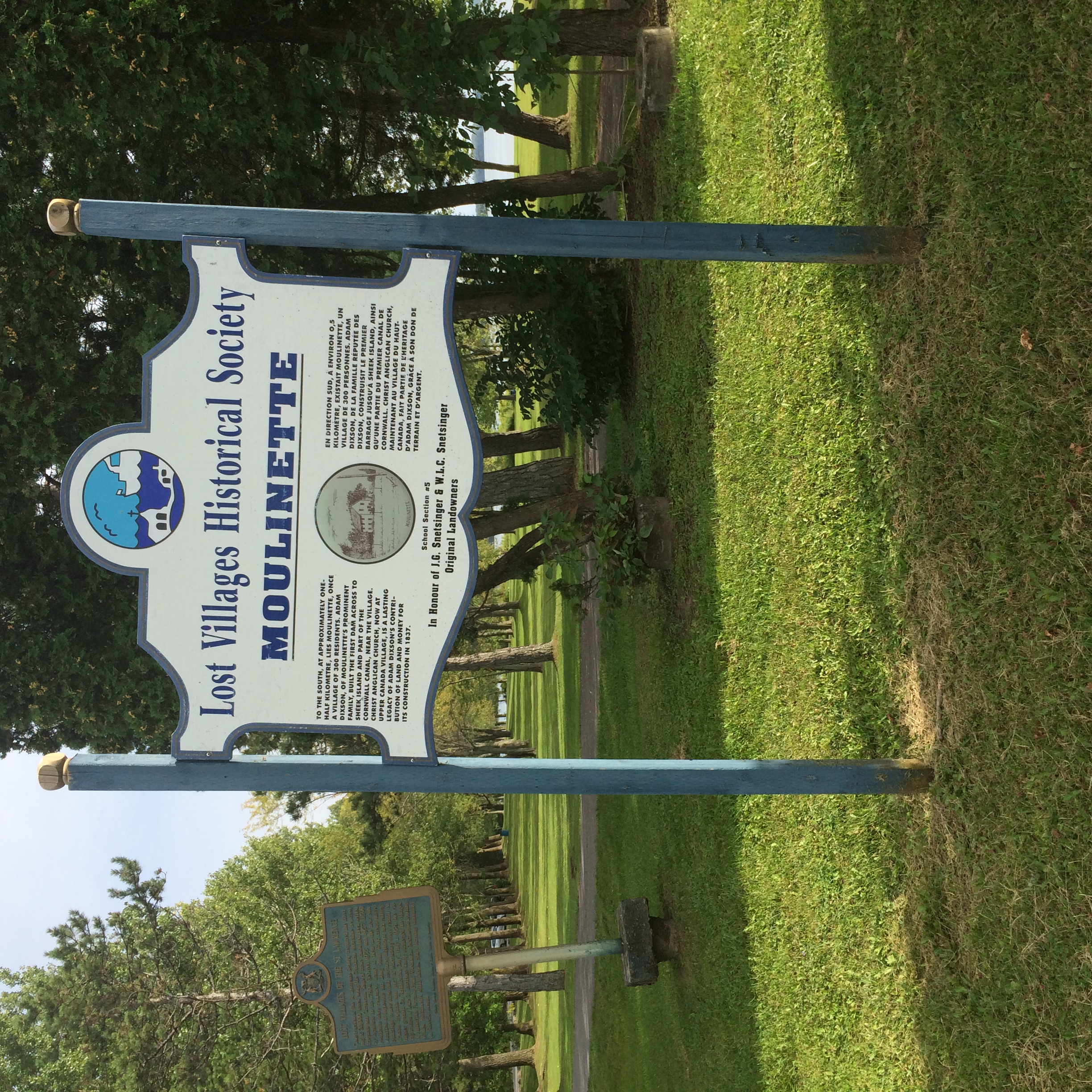 | 2,448 × 2,448 (2.68 MB) | Seanmcox (talk | contribs) | This picture was taken in August 2017. It is a sign posted [https://www.google.com/maps/@45.032284,-74.8576799,3a,75y,180h,90t/data=!3m6!1e1!3m4!1s0cW_S6RjC0P_R_rR8SeQiQ!2e0!7i13312!8i6656 near the original site of Moulinette], west of Cornwall. |
You cannot overwrite this file.
File usage
The following page uses this file: