File:Philpott Dam, planning map 3, Goblintown Creek junction.jpg
Original file (3,072 × 2,304 pixels, file size: 1.34 MB, MIME type: image/jpeg)
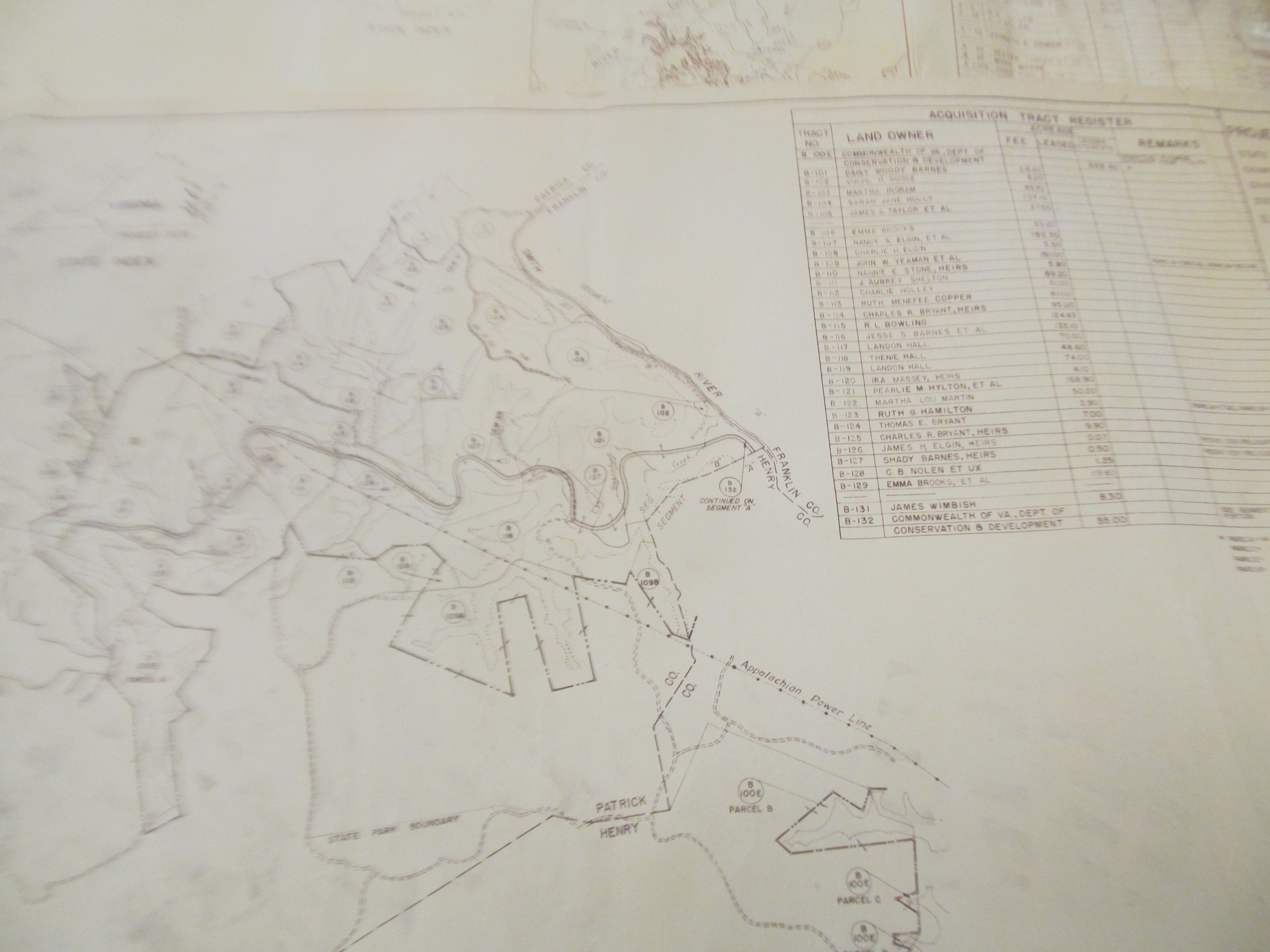
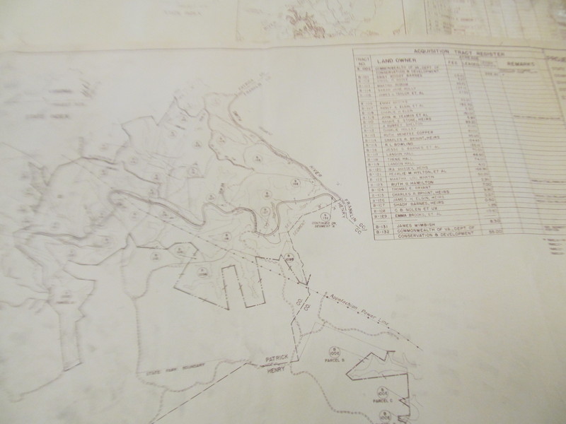
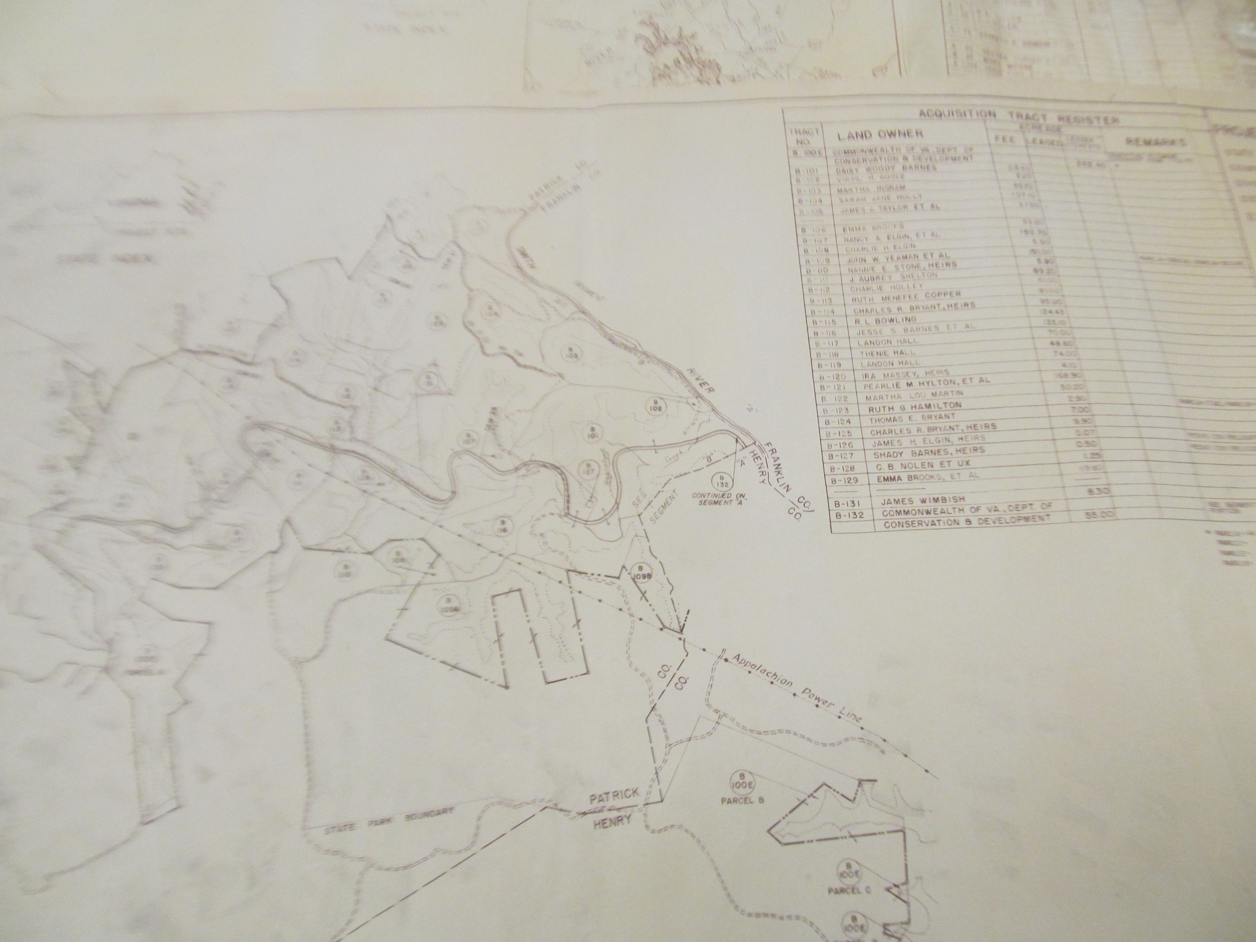
Picture taken at the Bassett Historical Center from a map they had on file. It dates from the period in which the Philpott Dam was being planned. It shows the junction of the Smith River and Goblintown Creek and outlines for nearby pieces of property.
This section shows the junction of the Goblintown Creek where it feeds into the Smith/Irwin river. The Smith River runs from the top of the image down to the boundary of the mapped area. The Goblintown Creek is harder to see, but is labeled. It begins on the left of the image and then flowed into the Smith River near the map boundary. The image is oriented such that North is up.
Related Images
File history
Click on a date/time to view the file as it appeared at that time.
| Date/Time | Thumbnail | Dimensions | User | Comment | |
|---|---|---|---|---|---|
| current | 18:03, 13 November 2016 | | 3,072 × 2,304 (1.34 MB) | Seanmcox (talk | contribs) | Picture taken at the [http://www.bassetthistoricalcenter.com/ Bassett Historical Center] from a map they had on file. It dates from the period in which the Philpott Dam was being planned. It shows the junction of the Smith River and Goblintown Creek an... |
You cannot overwrite this file.
File usage
The following page uses this file: